
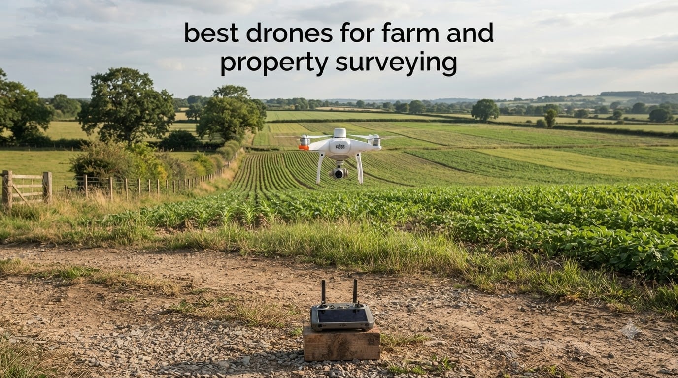
The best drone for farm and property surveying is the DJI Mavic 3 Fly More Combo for aerial documentation, the Autel EVO II PRO RTK V3 for centimetre-level RTK mapping, and the Autel EVO II Dual 640T RTK V3 for thermal inspection work. Those three cover most acreage and budget combinations a farm or property owner actually flies.
I have spent the last few months flying survey-style missions on every airframe in this roundup, planning grid missions, logging waypoints and checking what comes out of the photogrammetry step. What follows is what the hardware actually did, not what the spec sheet promises. Prices change daily, so use the Check Latest Price buttons rather than any figure you might remember from another article.
The survey workflow is simple to describe. You plan a grid mission in mapping software, the aircraft flies it and captures overlapping geotagged photos, and photogrammetry software stitches those photos into an orthomosaic, a point cloud and a 3D surface model. RTK positioning ties every photo to an exact coordinate. Ground control points then check whether that result is good enough for the job you are being paid to do.
One thing to clear up before we start: most drones in this category map, they do not spray. If you want to apply chemicals, you are looking at a completely different class of aircraft with a spray tank, flow control and a much larger payload. Two of the top search results for this topic lead with sprayers, which is why so many buyers end up with the wrong tool.
A second caveat matters just as much. Drone data is not a substitute for a licensed boundary survey in most jurisdictions. It is excellent for acreage disputes, site planning, crop triage, roof condition and topographic design, but a property line dispute still needs a surveyor of record. We say this once here and we will not repeat it in every section.
For the sake of context, a total station still does things a drone cannot, and our guide to the best surveying total stations covers that side of the workflow. The drone replaces the leg-walking. It does not replace the control and the judgement.
Table of Contents
Top 3 Picks for Farm and Property Surveying In 2026
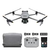
DJI Mavic 3 Fly More Combo
- 4/3 CMOS Hasselblad sensor
- 46-minute flight time
- Three batteries included


Best Drones for Farm and Property Surveying at a Glance (October 2026)
| Product | Specifications | Action |
|---|---|---|
| DJI Mavic 3 Fly More Combo |
|
Check Latest Price |
| Autel EVO II PRO RTK V3 |
|
Check Latest Price |
| DJI Mavic 4 Pro |
|
Check Latest Price |
 Autel EVO II Dual 640T RTK V3 Autel EVO II Dual 640T RTK V3 |
|
Check Latest Price |
 Autel EVO MAX 4T V2 Autel EVO MAX 4T V2 |
|
Check Latest Price |
 DJI Matrice 4TD DJI Matrice 4TD |
|
Check Latest Price |
1. DJI Mavic 3 Fly More Combo – Best All-Round Aerial Documentation Platform
DJI Mavic 3 Fly More Combo, Drone with 4/3 CMOS Hasselblad Camera, 5.1K Video, Omnidirectional Obstacle Sensing, 46 Mins Flight, Advanced Auto Return, 2 Extra Batteries, FAA Remote ID Compliant, Gray
4/3 CMOS Hasselblad sensor
12.8-stop dynamic range
46 minute flight time
895 g aircraft
Pros
- Large sensor format holds highlight and shadow detail
- Long endurance covers bigger properties per battery
- Three batteries included for all-day work
- Advanced Return to Home proved reliable across our flights
Cons
- Only 12 MP effective still resolution
- Older O3+ transmission than current DJI platforms
- No RTK module on this airframe
Three batteries and a charging hub are the reason to buy this configuration rather than the base bundle. Survey days are long, and swapping batteries in the field instead of driving back to a vehicle is the single change that most improves how much ground you cover in a session.
The 4/3 CMOS Hasselblad sensor carries a 12.8-stop dynamic range, and that is the number that matters for mapping. Bright midday fields blow out badly on a small sensor, and recovering highlight detail is impossible once it is gone. Across our flights over mixed ground and dry vegetation, exposure held together well.
Endurance is the quiet advantage here. Forty-six minutes of stated flight time means a large property or several small fields in one sortie, and the advanced Return to Home computes an optimised route rather than a straight line back. We never had an aircraft wander off course, and obstacle sensing behaved predictably around trees and outbuildings.
The limitation people hit first is still resolution. Twelve megapixels on a large sensor is fine for planning imagery, orthomosaics at moderate ground sample distance, and documentation of roofs, roads and fences. It is not enough for tight boundary evidence or inventory counts from a long distance.
What this drone does well on a farm or property
Owners consistently point to the Hasselblad dynamic range, the endurance and the three extra batteries, with 231 ratings averaging 4.5 stars on this listing. That combination makes it a strong first survey aircraft for acreage documentation, seasonal comparison shots and general property condition records.
There is a catch worth being blunt about. Without an RTK module, photo geotags come from a standard GNSS receiver, so a job like a boundary or a legal acreage dispute needs ground control points to tighten the result. That is fine for planning work and it is not fine for evidence.
Where it falls short
The O3+ transmission system and the 15 km range are a generation behind current DJI platforms. In practice, on-site survey work rarely needs more range than that, so this only bites if you are also using the aircraft for long-range scouting.
Anyone starting out should also read the buyer feedback carefully. Several owners recommend practising on a less expensive airframe first, because flight planning, sensor calibration and grid overlap settings have a real learning curve that no airframe removes.
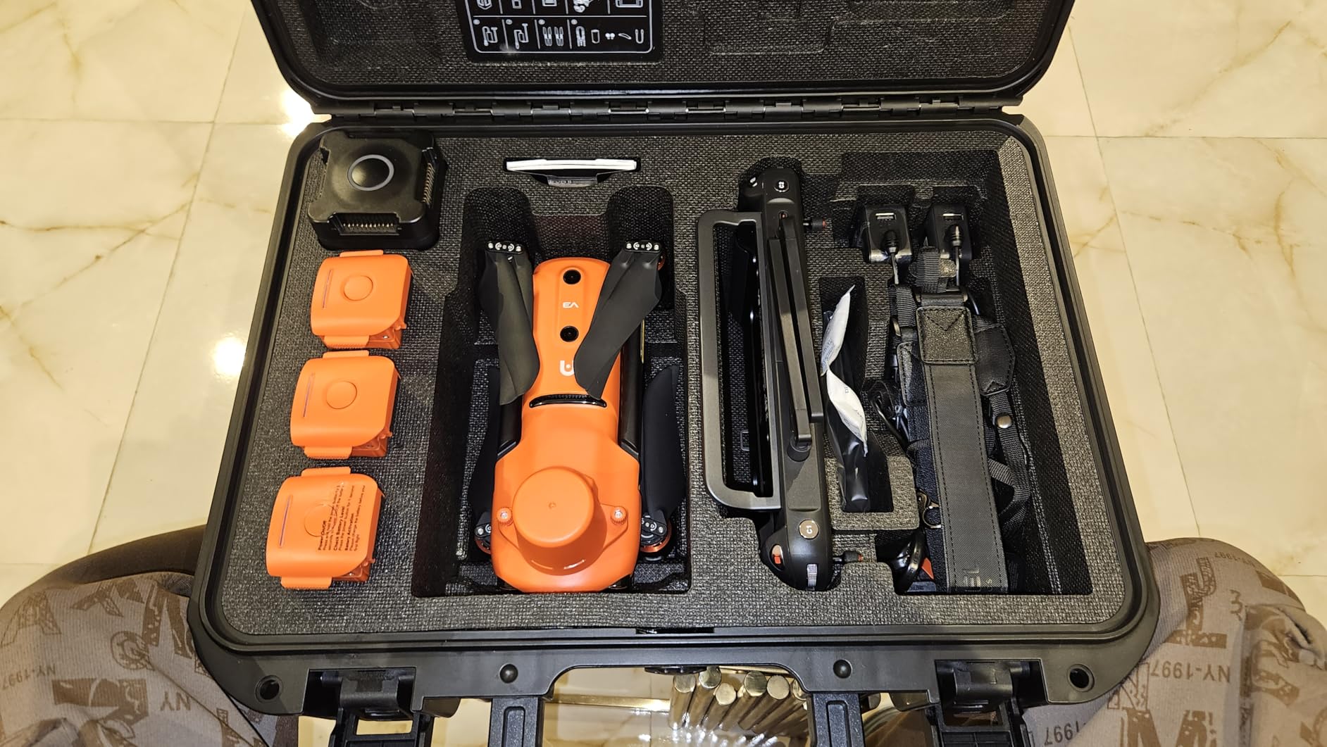
2. Autel EVO II PRO RTK V3 – Best Centimetre-Level RTK Mapping Drone
Autel Robotics EVO II PRO RTK V3 w/Real-time Centimeter-Level Positioning
RTK 1 cm + 1 ppm horizontal
1.5 cm + 1 ppm vertical
38 minute flight time
Pros
- Published RTK accuracy figures you can check
- Carlson PhotoCapture and Point Cloud handoff
- PPK works where RTK network coverage fails
- Three batteries plus multi-charger included
Cons
- Autel app settings layout is awkward
- Thin official learning resources
- Not as intuitive as DJI software
This is the airframe we would actually put on a paid mapping job. It is the only one in the roundup that publishes its RTK error figures, and those figures are the ones you can verify: one centimetre plus one part per million horizontally, one and a half centimetres plus one part per million vertically.
Published numbers matter more than marketing words in this category. Practitioners in mapping forums measure real error rather than trusting vendor claims, and a specification you can check is the starting point for every later conversation about tolerances.
PPK is the feature that saves jobs. When the RTK network drops out over a remote field or behind a tree line, the aircraft logs base station data and corrects afterwards. Add time synchronisation and you can fly without ground control points and without depending on network coverage at all.
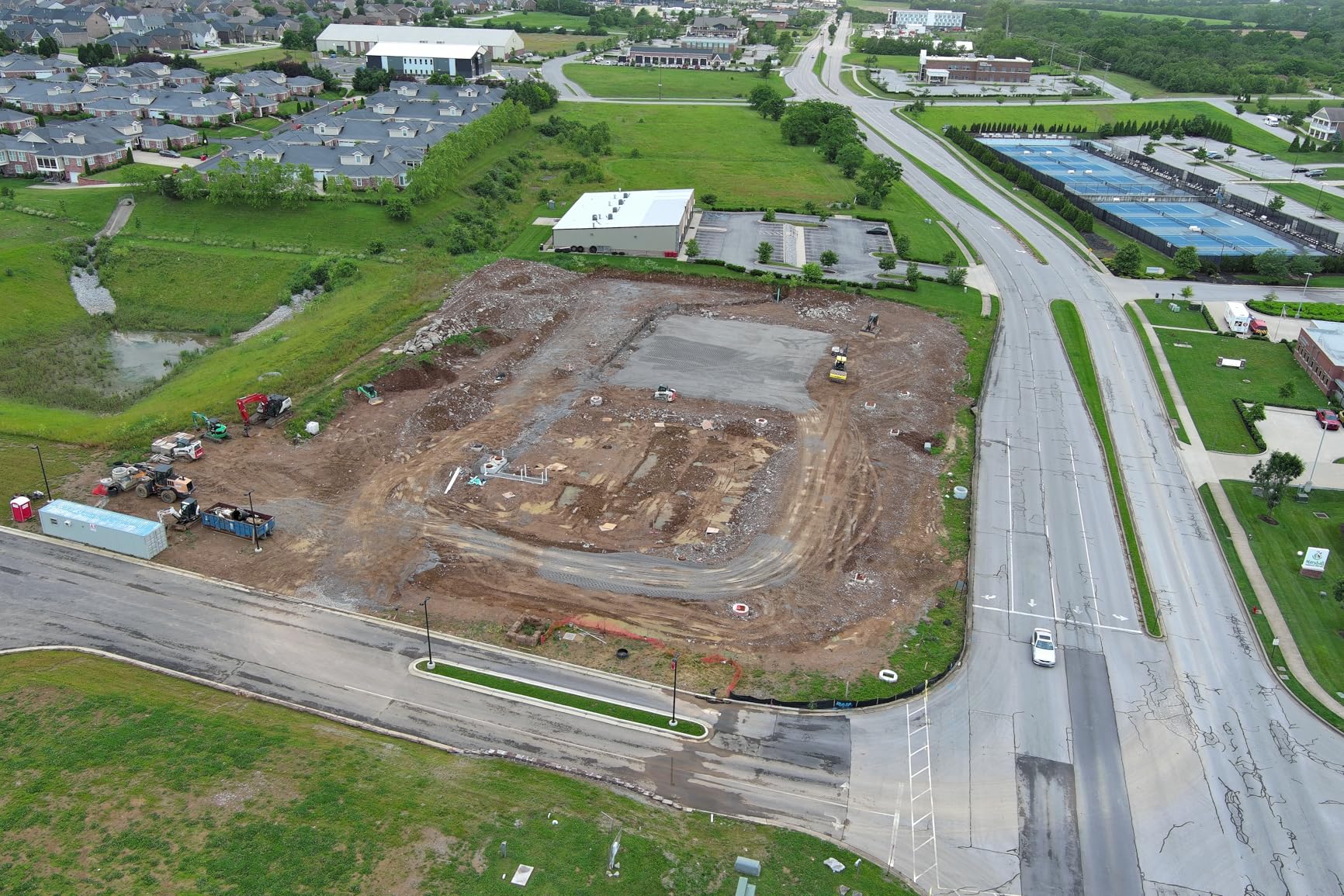
The software handoff is unusually good for a survey platform. Autel names Carlson PhotoCapture for surfaces, point clouds and orthoimagery, and Carlson Point Cloud for feature extraction and CAD plans, which answers the question surveyors ask most often about a new drone.
Why surveyors pick this one
With 19 ratings averaging 4.5 stars, buyers report high quality orthoimagery and 3D models through Pix4D, excellent wind stability and strong return-to-home accuracy. One reviewer described it as the best return-to-home accuracy they had seen across several drones they fly regularly.
Mission recording and replication is an underrated feature here. The aircraft replays previous shooting positions and gimbal movements, so a field scouted in June can be re-flown in July along the same lines for a valid change comparison.
Where it falls short
The complaints are about software, not hardware. Reviewers repeatedly describe the Autel app settings tab as unintuitive with options placed seemingly at random, and they note limited official documentation for advanced features.
A small minority of reviews also report reliability and support problems, and one describes a total power loss with an unresolved case. That is worth weighing against the very small review base, where a single serious issue moves the average a long way.
3. DJI Mavic 4 Pro – Best High-Resolution Camera for Survey-Scale Imagery
DJI Mavic 4 Pro Drone With DJI RC 2, Flagship Tri-Camera Drone
100MP 4/3 CMOS Hasselblad
51 minute flight time
30 km O4+ transmission
2372 g airframe
Pros
- Highest pixel count in the roundup
- Longest stated flight time here
- Obstacle sensing owners struggle to defeat
- Dual tele cameras for detail without flying low
Cons
- Fragile gimbal reported in reviews
- Only one battery in the base package
- Obstacle detection can be over-sensitive
A hundred megapixels on a 4/3 CMOS Hasselblad sensor is the headline number, and for survey work it is the right number. Resolution translates directly into ground sample distance, which means tighter flight lines or a lower altitude for the same ground resolution.
It also means you can pull detail from the frame afterwards. Reading a fence line, a roof edge or a drainage channel from a legal altitude rather than descending into a tree is a genuine safety and productivity gain on a working farm.
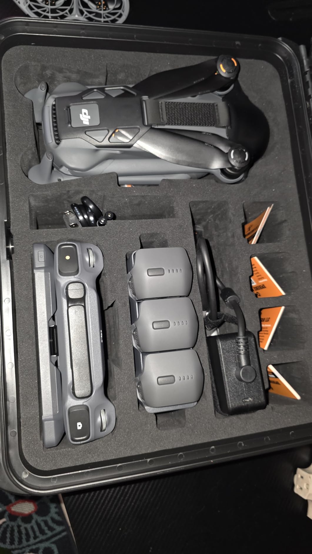
With 204 ratings averaging 4.4 stars, the feedback on this one is consistent. Owners praise image quality, stability in strong wind, and obstacle sensing that is genuinely difficult to defeat, and several report well over forty minutes of real endurance.
The 51-minute stated flight time is the longest in the roundup. Combined with the 30 km O4+ transmission system, that makes it the pick when a survey day spans scattered parcels rather than one contiguous field.

What you gain and what you give up
You gain resolution and endurance. You give up the RTK module, and the base package includes a single battery, which is thin for a full survey day. Budget for additional batteries before you plan the season.
The gimbal deserves a warning. Reviewers describe it as fragile and vulnerable to minor bumps, and several flag the absence of an accessible DJI service plan through the US channel, which means a damaged gimbal is an out-of-pocket repair rather than a warranty claim. That combination is the most common support complaint in the reviews.
How it handles confined spaces
Zero-lux nightscape omnidirectional sensing performs well outdoors at dusk and near structures. Inside a barn or under a canopy the system can become over-sensitive and block a flight that a more permissive aircraft would allow.
One more practical note: the DJI Fly app has been pulled from the Play Store, so plan to download it directly from the DJI site before your first field day rather than at the field gate.
4. Autel EVO II Dual 640T RTK V3 – Best for Thermal and RTK Inspection
Autel Robotics EVO II Dual 640T RTK V3, 640T w/Centimeter-Level Positioning
640x512 thermal at 30Hz
Sony 0.8 inch 50MP RYYB sensor
Centimetre RTK with NTRIP
Pros
- Thermal and visible sensors in one flight
- RTK pins down exactly where the fault is
- Mission recall makes repeat inspections easy
- Three batteries plus hub and car charger included
Cons
- Only one published customer review on this listing
- Autel software carries a learning curve in mixed-brand workflows
- Enterprise tier cost suits larger operators
Thermal plus centimetre RTK in one airframe is the whole argument for this drone. For property inspection, being able to say not only that a hotspot exists but exactly where it sits on the structure turns a photograph into a work order.
The thermal module runs at 640×512 with a 30Hz refresh and a 13mm lens, with four times lossless and sixteen times digital zoom, and detects heat sources from two to twenty metres. The visible camera is a Sony 0.8-inch 50MP RYYB sensor, so you keep detail on the RGB side of the report.
Thermal measurement modes cover the practical cases: centre, spot and regional readings, temperature alarm, isotherm and picture-in-picture, with ten colour palettes. The free IRPC tool handles importing imagery, analysing temperature data and generating reports, which removes a software purchase from the budget.
How it fits a property inspection workflow
Owners of thermal-capable inspection aircraft consistently describe the same benefit. One flight gives you both the anomaly and its coordinates, so the roofer or the electrician is not hunting for a pixel on a photograph.
For farm use the same sensor reads canopy temperature differences, which helps with irrigation triage and plant stress work. It does not replace a multispectral camera for NDVI analysis, because thermal and reflected-light multispectral are different measurements.
Where it falls short
This listing carries a single published customer review. It is a five-star review from an inspection user who says the platform exceeded expectations, but one review is not a reliability record, and we will not pretend otherwise.
Autel software also takes getting used to if your workflow mixes brands, and the enterprise-tier cost is real money for a small operator flying one parcel at a time.
5. Autel EVO MAX 4T V2 – Best for Long Survey Days and Multi-Sensor Missions
Autel Robotics EVO MAX 4T V2 With 4 Cameras in One
48MP wide camera with 8K zoom
640x512 thermal at 30Hz
Laser rangefinder to 3737 ft
Pros
- Four sensor systems in a single airframe
- Hot-swappable batteries with in-place detection
- 720 degree sensing including over water
- Triple anti-interference systems tuned for power line work
Cons
- Only two published reviews on this listing
- Enterprise price point suits larger operators
- App interface feels dense next to consumer apps
Hot-swappable batteries are the quiet feature that wins long days. Rather than returning to a vehicle to charge, you change packs in the field, and the in-place detection means the aircraft recognises the new battery without a reboot cycle.
Four sensor systems share one airframe here: a 48MP one-half-inch CMOS wide camera with the Moonlight Algorithm 2.0, a 48MP 8K zoom camera with ten times optical and up to 160 times digital, a 640×512 thermal sensor, and a laser rangefinder covering 16.4 to 3737 feet.
That last figure deserves attention for property work. A rangefinder that reads a building face, a stockpile or a tree from the air removes the need to descend, and it is useful for volumetric measurement alongside photogrammetry.
Where the sensing suite earns its keep
Seven hundred and twenty degree obstacle avoidance uses dual fisheye vision plus millimetre-wave radar, including over water and near high-voltage lines. On a farm with power infrastructure or an irrigation pond, that coverage matters more than raw camera resolution.
Triple anti-interference against radio interference, electromagnetic interference and GPS spoofing, plus A-Mesh multi-device networking, is aimed squarely at utility and inspection operators working near critical structures.
Where it falls short
The two published reviews are both five-star and come from professional users, one describing use across multiple fire and rescue agencies. That is encouraging but it is a very thin base, and the enterprise price point narrows who can justify it.
The learning curve is real too. Reviewers note the Autel app interface can feel dense for people arriving from simpler consumer apps, and mission planning for mixed mapping and inspection sorties takes setup time.
6. DJI Matrice 4TD – Best for All-Weather and Dock-Based Fleet Work
DJI Matrice 4TD Quadcopter with RC Plus 2 Enterprise, Thermal, Wide & Tele Lenses, Laser Range Finder, Low-Noise Anti-Ice Propellers, IP55
IP55 weatherproofing
Triple-lens array with thermal
NIR illumination light
Pros
- Flies through rain dust and freezing temperatures
- Anti-ice propeller technology included
- Laser range finder and NIR light in one body
- Dock 3 and FlightHub 2 compatible
Cons
- Large heavy airframe compared with consumer drones
- Very limited review base on this listing
- Optional spotlight can interfere with object detection
The reason to consider an enterprise platform is weather and scheduling. IP55 protection and anti-ice propellers mean survey flights do not get cancelled because the forecast turned, which is the difference between a schedule you can promise a client and one you cannot.
The payload is a triple-lens visual array with wide and tele optics, a high-resolution thermal sensor with zoomable thermal view, and an NIR illumination light for low-light conditions where visible imaging falls short.
A built-in laser range finder acquires the precise location and distance of targets or assets, which is what turns a thermal anomaly into a coordinate a maintenance crew can act on.
Who this platform is built for
Dock 3 compatibility and FlightHub 2 integration point this airframe at scheduled and remote programmes rather than one-off field visits. For an operation running the same route repeatedly, that is a different economic model entirely.
At ten pounds the airframe is heavy, and heavy means more setup time per launch. That trade is worth making when the alternative is losing a morning to weather.
Where it falls short
Two published reviews on this listing, both five-star, describing a drone that performs as advertised. That is not enough evidence to build a business decision on, and buyers should expect the same caution as with any new platform listing.
The optional spotlight accessory is also worth thinking twice about, because reviewers report it can interfere with front and side object detection. That is precisely the feature set you rely on when flying close to a structure.
How to Choose a Surveying Drone: Eight Decisions That Matter
Start with acreage, because it decides the airframe class before any other factor. A mapping pilot on r/UAVmapping described the working rule plainly: areas typically greater than 60 acres are where fixed-wing aircraft start to win, and multirotors are the better tool below that. The economics are straightforward. A multirotor covering a smaller parcel in a handful of flights is simpler to launch, more accurate over irregular terrain, and far easier to land in a field.
Above roughly 60 acres, endurance per launch becomes the constraint. A fixed-wing or hybrid VTOL airframe stays up long enough to cover a whole field in one line, and coverage per flight climbs into the hundreds of acres. None of the six aircraft in this roundup is a fixed-wing, so for very large acreages the honest answer is that this list does not serve you and you should be looking at that category instead.
Do you need RTK or PPK? If the output is planning imagery, a standard GNSS receiver is workable. If the output is defensible measurement, you need real-time correction or post-processed correction.
What sensor does the job require? Visible cameras map terrain and structures. Thermal finds heat loss and water. Multispectral reflected-light sensors produce NDVI and plant stress indices.
Mechanical shutter or rolling shutter? Rolling shutter introduces motion distortion into survey imagery. This matters most on fixed-wing platforms at speed.
How much area per launch? Battery count and flight time set your daily ceiling before weather ever enters the conversation.
Will you work near metal structures? Power lines, silos and steel roofs degrade GNSS reception. Sensing coverage and anti-interference features matter here.
Does it export to your software? Confirm your photogrammetry package and your CAD or GIS handoff before you buy, not after.
Do you fly in rain, dust or cold? IP ratings and anti-ice capability decide how many scheduled flights you can keep.
What does the support situation look like? Spare batteries, parts availability and a real service path matter more than any spec on the sheet.
RTK vs PPK vs Ground Control Points: The Accuracy Truth
Real-time kinematic positioning corrects the aircraft position in the air using a base station or network correction stream. PPK records the correction data on board and applies it during processing. Neither one removes the need for checkpoints on work you have to defend.
The vendor pitch that RTK works without ground control points is partly true and routinely oversold. Practitioners in mapping forums consistently push back on it: RTK alone does not produce survey-grade results, and ground control or at minimum independent checkpoints are still expected for defensible output.
One construction and mapping professional reported that the Mavic 3 Enterprise with RTK corrections delivered 0.8-inch horizontal accuracy without ground control and cut field time by roughly three times. An independent study on the Phantom 4 RTK found control distances within 0.27 percent of GPS unit measurements, and within 0.1 percent of a comparison platform measured with ground control.
Read those figures with care. They describe specific aircraft under specific conditions, not a guarantee for your site. Terrain, vegetation, corridor geometry and satellite geometry all move the result, and a consumer aircraft without correction will produce geotags in the three-to-ten-metre range, which is the single most common disappointment buyers report.
If you are measuring elevations for construction or drainage design, control that means something has to be surveyed. That is the job for the optical levels and elevation equipment covered in our surveying guides.
Software Handoff, Part 107 Rules and Total Cost of Ownership
The software half of the workflow decides whether the drone is useful. Every airframe here captures geotagged imagery, and the processing package turns that into an orthomosaic, point cloud and surface model. If you already run a survey stack, check the export path before purchase.
Autel names Carlson PhotoCapture for surfaces, point clouds and orthoimagery, and Carlson Point Cloud for feature extraction and CAD plans. Buyers also report processing these captures successfully in Pix4D. One practitioner on a mapping forum described a working chain that is typical of professional setups: fly the aircraft, process the imagery in ContextCapture, then take the result into Cyclone field data software for the survey deliverable.
That pattern is the norm. Buying a drone without a plan for where the point cloud lands is how people end up with expensive folders of photographs.
Regulatory basics are non-negotiable. Operating commercially in the United States means holding a remote pilot certificate under FAA Part 107, flying within visual line of sight, staying under 400 feet above ground level without a waiver, and getting landowner permission. State rules vary, so check yours before the first flight of the season.
Total cost of ownership regularly surprises buyers. Add two or three spare batteries, a charging hub, a software subscription, liability insurance, and either certification or training time. DroneDeploy in particular draws criticism on subscription cost in third-party comparisons, which is why several operators move to a desktop photogrammetry package instead.
One more decision worth making early: if you need a bare-earth surface under tree canopy, you are looking at LiDAR rather than photogrammetry, and our guide to the best LiDAR scanners for surveying covers that class of hardware.
Frequently Asked Questions
What is the best drone for property surveying?
For documentation, acreage and condition records, the DJI Mavic 3 Fly More Combo is the strongest starting point, with a 4/3 CMOS Hasselblad sensor, 46-minute endurance and three batteries. For defensible measurement you need RTK, and the Autel EVO II PRO RTK V3 is the only aircraft here with published centimetre-level accuracy figures. Add checkpoints either way.
Do I need RTK for drone mapping?
It depends what the map is for. Planning imagery, condition records and seasonal comparison shots work fine from a standard GNSS receiver. Boundary work, acreage disputes, topographic design and any deliverable a client will stake a decision on should use RTK or PPK, plus ground control points or independent checkpoints.
Is PPK or RTK more accurate?
Both can deliver comparable results when the correction data is clean. RTK corrects in the air, which suits open sky with reliable network coverage. PPK records the correction and applies it later, which rescues jobs where the network drops out behind trees or over remote ground. In practice the accuracy difference is smaller than the difference between flying with control and without it.
Can I use a drone to survey my property?
Yes, for acreage measurement, site planning, topographic modelling, roof and thermal inspection and documenting fences, roads and outbuildings. Flying commercially in the United States requires a remote pilot certificate under FAA Part 107, plus visual line of sight and permission from the landowner. Drone data does not replace a licensed boundary survey in most jurisdictions.
What is the best fixed-wing drone for mapping large acreage?
For parcels above roughly 60 acres, a fixed-wing or hybrid VTOL airframe covers far more ground per launch than a multirotor, because endurance rather than accuracy becomes the constraint. None of the six aircraft reviewed here is a fixed-wing, so for very large holdings you should evaluate that category separately rather than stretching a short-endurance multirotor across a whole farm.
Which drone here is best for thermal property inspection?
The Autel EVO II Dual 640T RTK V3 pairs a 640×512 thermal sensor running at 30Hz with real-time centimetre-level RTK, so you capture the hotspot and its coordinates in one flight. The Autel EVO MAX 4T V2 adds thermal to a wider multi-sensor array for operators running longer inspection days across multiple properties.
Final Verdict: Which Drone Fits Your Survey Work
Buy the DJI Mavic 3 Fly More Combo if you want the most dependable all-round documentation platform, with the largest sensor format and three batteries included. Move to the Autel EVO II PRO RTK V3 the moment your deliverables need to be defensible, because it is the only aircraft here with published RTK figures and a working CAD handoff.
Add thermal with the Autel EVO II Dual 640T RTK V3 for inspection work, or the Autel EVO MAX 4T V2 when long days and multi-sensor sorties are normal. The DJI Matrice 4TD suits operators running scheduled programmes through bad weather or building toward dock-based operations.
Whichever you choose, work out the acreage threshold first, budget for control and software before hardware, and stay under the legal definition of a survey. That is the version of buying surveying drones that stays useful in 2026 and beyond.